We took advantage of perfect weather to take a long circle drive through the nearby mountains. In West Vancouver a winding road, Marine Drive, took us  Stawamus Chief
through up-scale neighborhoods with bright small shops, little restaurants and large houses. It claims to be the second wealthiest community in Canada. We checked out the Horshoe Bay ferry terminal, where a long line of cars was queued up for the next ferry to Vancouver Island.
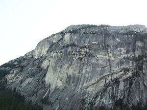
Highway 99 runs due north alongside Howe Sound, whose waters narrowed like the fjords of Norway. Coastal mountains spilled their trees right down to the water's edge. Just short of Squamish we sighted the Stawamus Chief, claimed to be the second largest monolith in the world. We were suitably awed by The Chief, and saw some young men preparing, perhaps, to start their climb.
Perhaps because it is officially bilingual, Canada uses more non-verbal road signs. It took us a little while to get used to the small solid black octagon with a red slash through it: Don't Stop. There were lots of these  Whistler ski slopes
signs along today's drive; because there are plenty of rock slides and the occasional avalanche to deal with. We know this because today there were plenty of rocks, usually small, which had recently slid down the steep slopes. We also know this because we saw countless hillsides equipped with heavy steel netting to prevent the worst of the slides from annihilating the passing traffic. There are also lots of cute signs with the outline of a hill and rocks falling, all in regulation highway black on yellow.
We stopped at all the view points and historical signs we saw; fortunately the traffic was light enough to let us cross the road to pull off whenever we wanted.
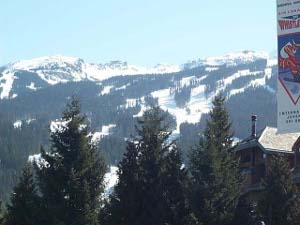
Most of the traffic was going to or coming from Whistler, British Columbia's major ski resort. There were plenty of skiers and snowboarders enjoying spring skiing, though the roads were clear and dry, and the sun was melting the snow rapidly. The town of Whistler reminded us of Mont Tremblant in  Melting brook
Quebec; it looked as if miles and miles of modern condos and hotels and restaurants and shops suddenly sprang into existence yesterday!
We drove through virtually unpopulated country north of Whistler: Pemberton is a farming community in the Lillooet River valley, and we passed through a small First Nations Band settlement. The next 99 kilometers to Lillooet were wilderness; the only cars were parked at cross-country ski trails. We drove along bubbling streams, mountain lakes, plenty of hills, and forests all about. No moose, though; in fact we were disappointed that we didn't see any wildlife. Most of the bridges were one-lane affairs, with wooden roadbeds.
Weeks ago, in Fort Tejon, California, we saw a sign commemorating the U. S. Army Camel Corps; the Army thought the camels would be good beasts of burden in the Southwestern deserts. The sign said the experiment "proved to be a failure." So, naturally, the camels were disposed of as Army Surplus. They wound up in Lillooet, British Columbia, where prospectors hoped to use them in place of mules. But the camels stank and kicked and threatened all the other animals and cut their feet on the sharp rocks. The Bridge of 23 Camels in Lillooet tells the whole story; the remaining camels lived almost 40 more years as ranch pets.
We ate in a Greek restaurant in Lillooet. Evidently lots of Greeks have  Plenty of snow yet
settled in British Columbia; their restaurants are always called Taverna. The owners of the restaurant in Lillooet have another one even further north. We haven't yet found out what event in history brought the Greeks so far away from home.
South from Lillooet the Trans-Canada Highway (TCH) follows the Fraser River Canyon, a deep gorge surrounded by steep slopes. This was no freeway; in fact the road workers clearly have to struggle to keep the highway open year round. There were numerous signs of rockslides and avalanches. At one point the repairs hadn't been completed, and we followed a one-lane trail marked out by traffic cones, with loose rocks on the left side and a partially washed out precipice on the right. Yeah!
We stopped at several lookouts and could barely make out the river through the forested slopes and rocky cliffs. It's a lovely sight. At Hell's Gate there is an aerial tram that carries tourists down the eastern slope to a tram stop on the west banks for a closeup view of the River at its narrowest part. It wasn't open for the season yet. Further south the engineers tunneled through the hillsides; there are seven such tunnels north of the town of Yale.
 Hell's Gate suspension bridge
Most of the small towns on the Fraser River are Gold Rush towns. Evidently the gold fever moved up the west coast, starting in California in 1849 and ending in the Klondike in 1898; but prospectors and gold and silver mining continued well into the 20th century (and in some places is still going on).
We were soon in Hope, where the TCH changed into a freeway for the final two hours back to Vancouver. Here the Fraser River valley is wider and more heavily farmed, and here are the main ports of entry to the State of Washington. Returning to Vancouver after sundown we saw the lighted ski slopes on Grouse Mountain, just north of the city.
With the exception of Prince Edward Island, all Canadian provinces have substantial amounts of wilderness. In British Columbia, most of the settlement is in the temperate southwest. Just a short drive north brings you to rugged and wild country. This was a wonderful day trip.
 Stawamus Chief
through up-scale neighborhoods with bright small shops, little restaurants and large houses. It claims to be the second wealthiest community in Canada. We checked out the Horshoe Bay ferry terminal, where a long line of cars was queued up for the next ferry to Vancouver Island.
 Whistler ski slopes
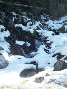
 Melting brook
 Plenty of snow yet
 Hell's Gate suspension bridge