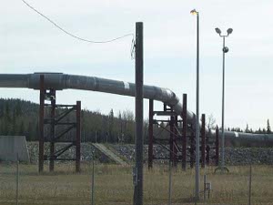
 Transalaska pipeline
At 1979 miles, the Yukon is one of the longest rivers in North America; it drains 330,000 square miles and empties into the Bering Sea in a mighty delta. It has dozens of tributaries, many of which were searched in the Gold Rush 100 years ago, and it is still the location of serious placer mining. For five months, when it's not frozen over, it's a navigable river, and was the principal means of bring in supplies for the gold mines.
 Transalaska pipeline
So it is something of an oddity that the Yukon, which runs 1200 miles across the center of Alaska, can't be reached by paved roads in the state. If we had followed the Alaska pipeline up the gravel Dalton Highway (which has the only bridge over the Yukon in Alaska), or continued up the Steese Highway to the tiny town of Circle, or if we had driven up the Taylor Highway today to the small town of Eagle, we would have reached the river. But in fact, we left the Taylor Highway at 3:30, still 70 difficult miles from Eagle and cut across the Top of the World Highway to Dawson City, which gave us our first glimpse of the Yukon.
This drive from Fairbanks to Dawson was twice as long as we usually go; we didn't allow enough time for the terrible roads. But we felt great and enjoyed every mile of what was probably our most scenic drive in months.
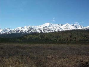
Leaving Fairbanks we went through North Pole (no, grandchildren, Santa Claus was not in sight, although there may have been some elves at work) and Eielson AFB, where we saw F-16s, A-10s, and a B-52 parked near the runway. Then we ran towards Delta Junction and Tok on a tangent to the curving arc of the Alaska Range, which stretches from the Yukon border around to the Alaska Peninsula. Mt. Hayes, over 13,000 feet, dominated the skyline.
 The Alaska Range
Delta Junction is a bit of a farming community; about 100 square miles of land is used for forage crops and grains, mostly barley. We drove up one of the back roads and came upon a bison farm; in fact a good-sized herd of wild bison is on a game reserve south of town. But these bison were introduced into the area in recent times.
The bison weren't the only interesting animals we saw today; in fact this turned out to be our best day for spotting wildlife. We began with a short critter, about the size of an average dog, with black and gold fur by the side of the road. Good thing we had paid attention to stuffed animals in Alaska museums. This was a wolverine, and we saw four more wolverines before the day was out. We also counted five moose, in ones and twos, a black bear, who looked hard at the truck before shambling back into the woods, and three interesting birds. The first bird had a brown body, with black wings, and a beautiful black head with two tufts of golden feathers; it was a male horned grebe, and sat on a small pond like a duck, presumably guarding a nest where the female was hatching eggs. The other birds were a pair of common mergansers, also beautifully colored. We're grateful for Sibley, our bird book, and get a great kick out of thumbing through the pages until we identify each one.
We stopped for a great brunch in Tok, and can recommend sourdough pancakes, which have a nice tang to balance the syrup, and bumbleberry pie.
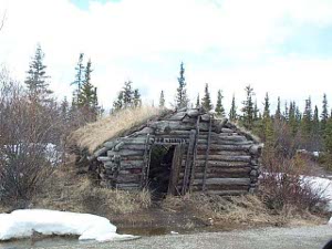
The Taylor Highway cuts north from Tok towards Eagle, a distance of 175 miles of steadily degrading road. It first ascends the shoulder of Mount Fairplay (one of us made a Freudian slip and mispronounced the name) and then winds along rivers lined with the tailings of gold mines. About 30 miles north  Roadside cabin
of the mining town of Chicken (the miners wanted to name it Ptarmigan, but couldn't agree on the spelling) we left the Taylor Highway for the Top of the World Highway to Canada.
Ascending from the riverside, the Highway, which is actually an old wagon road, winds along the ridges of mountains worn down by the Ice Age glaciers. It crosses a pass of 4500 feet close to the border, which is well above tree line and closed in winter. The border guards come to live in this pass and keep the crossing open for twelve hours a day.
From the high ridges we had views of snow-covered rounded mountains stretching many miles in all directions. Despite the difficult road (gravel with muddy patches in Alaska, paved with many potholes and muddy patches in Canada) we were thrilled with this gorgeous highway.
At the end we looked over a bluff down at the mighty Yukon and Dawson City. There was no bridge; we crossed on a small ferry and found our motel and crashed.