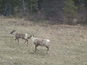
 Caribou
often pulling a car or light truck. Remembering the RV parks, nearly full, in Whitehorse and Dawson City, we wondered where they would all fit.
Continuing our trip south and east through Yukon and into British Columbia we found the trees greener, the air warmer, the snow almost gone and the RVs multiplying. Northward they come, mammoth fifth-wheels and buses and campers,  Caribou
often pulling a car or light truck. Remembering the RV parks, nearly full, in Whitehorse and Dawson City, we wondered where they would all fit.
Only an hour or so on the road we found our first two black bears of the morning, and in the next couple of hours we had three more bear sightings for a total of five. They were munching away on fresh spring plants near the highway border, and scampered / lumbered away when they became aware a car or two had stopped.
We generally stop, or at least slow down, when we see another vehicle parked by the side of the road. We're often rewarded for our curiosity. We're amazed at the number of drivers who barrel on along, not even turning their heads. When they're done they'll say "where was all the wildlife?" We're glad we have no planned schedule, just take time to enjoy what interests us.
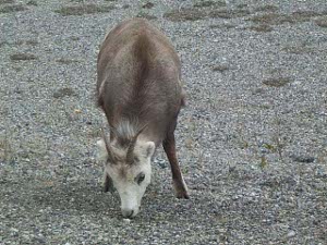
After stopping at the Yukon/B.C. boundary marker, where the 1997 surveyors had immortalized themselves by placing a brass plate with their names as well as the date and geographic identification, we made our next pause at Liard River, a beautiful, broad fast-moving river bordered by trees. We followed a short path to a clifftop overlook of a mineral lick reputed to be  Stone sheep
popular with the ungulates. All we turned up were two German couples. We agreed that the view was sehr schoen.
Liard Hot Springs is a "must see" highway stop, which can get quite crowded in summer. There were only a few people bathing in the pools; the hot source is 53 degrees Centigrade, but cools to about 45. The warm pool is about 42. There's a natural hillside garden, and lots of unusual flora and fauna that survive only in this geothermal area.
According to one of the Tourist Centers, we passed through the "Serengeti of North America" and soon we were sighting more wildlife. Muncho Lake is twenty miles long and seven miles wide and rather green, colors due to the composition of minerals at its deep bottom. It's about 4000 feet in altitude, and along the shores we saw a small flock of Stone sheep - ewes and lambs grazing and licking salt near the highway. These sheep are biologically and geographically midway between the Rocky Mountain Bighorn sheep and the Alaskan Dall sheep.
We stopped for a good lunch at the Toad River Lodge where we admired their many baseball caps; the rumor is if you don't watch closely your cap will  caption
be nailed to the ceiling or wall and added to the collection.
Continuing after lunch we bagged (figuratively) two caribou, one cow moose with her very young calf, and a female elk. For quantity and variety of wildlife spotted, this was one of our best days on the road.
Our goal for driving is just four or five hours per day, with plenty of time for hiking and sightseeing. But here in the Yukon and northern British Columbia we find ourselves in the middle of nowhere after four or five hours, so we have to drive a few more hours to the next good-sized town. Fortunately there's plenty of daylight, and we've been getting an early start.
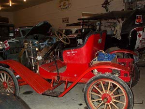
So it was late afternoon when we reached Fort Nelson, where we gassed and washed the truck. But the tourist information center and the museum were still open. The museum is amazing for a town of this size; it's full of photos, news clippings, stuffed animals (including a white moose), antiques of every size and shape, including lots of outdated automotive, agricultural, mining, and forestry equipment in the surrounding yards and barns. This museum deserves a federal or provincial grant to build a fine large new building to house all the treasures, and the services of a curator to record the history that lies behind the items.
 Fort Nelson Museum
At the tourist information center we received invitations to attend a slide show, depicting the history and attractions in and around the city. We learned that this is a town NOT relying on tourism; there's a thriving lumber industry that makes oriented strand board, and brought in a lot of families from the closed paper mills in Newfoundland. There's a natural gas processing facility, where the sulfur is removed before piping the gas south -- some of it all the way to California. Gas and oilfields are spread out to the north and east. There are even a handful of buffalo ranches. So Fort Nelson marks the first town we've seen since Fairbanks that doesn't rely heavily on tourism to survive. But it is still interesting to understand that the string of North West Mounted Police posts, which were established in northern British Columbia around 1800, remained basically trading posts for trappers until the coming of the AlCan highway in 1942. The road opened up the country enabling the growth of forestry and mining.