 Petrified Forest
 Petrified Forest
We breakfasted in the oldest restaurant in Holbrook, Arizona. This tiny town celebrates its place on the old Route 66 with murals and some buildings which have escaped the wrecking ball. Holbrook also bills itself as The Home of the Petrified Forest National Park; a vast assortment of petrified wood and other rocks seems to illustrate its major industry.
We found Puerco Pueblo the most interesting part of our drive through this small National Park. The pueblo ruins have been left unrestored, but the desert is its own preservative and the low walls give a good indication of the many small rooms which housed a busy community hundreds of years before our earliest ancestors arrived from Europe. The pueblo site contains some interesting petroglyphs as well.
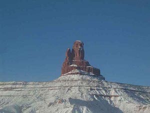
The road from the Petrified Forest goes directly through the Painted Desert -- you can't do one without the other, and the territory is so small you  Tower near Kayenta
wouldn't want to miss either one. Even on this overcast winter day the colors of the desert floor and outcroppings were dramatic and beautiful -- panoramic views on either side.
Our entire day was spent on the Navaho and Hopi Indian Reservation, including lunch with Navaho fry bread. The small communities varied from tidy farm towns to a few poverty-stricken areas with some falling-down buildings.
By day's end there was snow, but the few inches here in the southwest pale in comparison with -- gasp! -- the seven feet that has fallen in Buffalo in a week. We hope all our Buffalo friends are safe and sound.
 River near Natural Bridges
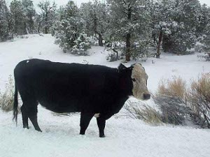
Continuing northward we drove through some of the most spectacular scenery in the United States. In the morning we headed north through Monument Valley to Mexican Hat, named for a rock formation outside of town that looks like an upside-down sombrero. We then headed north on Utah 263, which is still a dirt road as it winds giddily up the side of a mesa, past early morning open-range cows who waited dumbly in the road for us to drive slowly by, and on to Natural Bridges, where we took the loop road. By the second bridge we were ahead of the park ranger who was shoveling off the morning snow from the paved walks.
From Natural Bridges to Capitol Reef is just one breathtakng view after another, as Southeastern Utah pulls out all the stops. We don't know the proper geological names for half the formations, but erosion has created cliffs and buttes and reefs upthrust at sharp angles, with stratified layers and  Range cattle
variegated colors. Not even a cloudy day could dull their splendor.
We took the scenic drive at Capitol Reef (the "Egyptian Temple" is aptly named and lovely) and shot more pictures before climbing an 8300-foot pass on the way to Salina.
We drove highway US 83, the old main road up the Utah Valley past cattle ranches and LDS churches - it seemed like an equal number of each. The snow was wet and the clouds hung low, and the traffic was not as light as it was in the beautiful National Parks country, so we came in to Sandy, just south of Salt Lake, on New Years' Eve. We continued to type away at our genealogical notes, and got to bed early. The next day we checked into the Marriott in Salt Lake City, where we will stay a few days working at the world's best family history library.