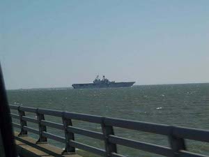
 Aircraft carrier
The Chesapeake Bay Bridge Tunnel is a definite E-Ticket ride. After the hail storm last night, the sky was bright blue, the wind was light and chilly and there was just a hint of whitecaps on the water. As we entered the long causeway an aircraft carrier put out to sea in front of us, gliding across the gap where the Thimble Shoals Tunnel lies: a pretty exciting sight for Navy groupies like us!
 Aircraft carrier
With all the bridges, causeways, and tunnels, we seemed to spend hours crossing the huge bay, although it was probably less. On the Eastern Shore are small farms. From our less-than expert perspective, some farmers were raising chickens for Tyson or Perdue, while the rest were growing grain to feed the chickens. Actually, we saw indications that they raise potatoes and corn here, too.
The flowers of the season right here are cherry trees (or apples, possibly) and brilliant yellow forsythia bushes. We're still chasing early spring as we move northward.
We followed small back roads, through Modest Town and Nelsonia, where some of the houses look hundreds of years old.
Suddenly, in contrast to the old wooden houses, we found an array of satellite tracking radars and an airstrip at the NASA Wallops Island Flight Facility. There's a fine visitor center here; this facility works mostly on suborbital space research, launching sounding rockets and high altitude helium baloons, with recoverable instrumented payloads. The payoff is better understanding of cosmology, thunderstorms, auroral activity, etc.
 Flowering (cherry?) tree
Those of us who grew up with Misty of Chincoteague, Stormy: Misty's Foal, and other children's books by Marguerite Henry know about the half-wild ponies who live on these marshy islands. According to our AAA Tour Book, "Local legends say that Chincoteague ponies, an island trademark, are descendants of mine horses that survived the shipwreck of a 16th century Spanish galleon. Most historians, however, agree that the first ponies were brought over by the first English colonists, who turned the herds loose on Assateague and Chincoteague in the late 1600s when the horses began to damage their crops." Anyhow, we saw them, along with deer and Canada geese, feeding on the grasses in the wildlife refuge.
We also saw the proverbial herd of turtles - dozens of them on the bank - along with Canada geese, egrets, herons, and shovelers. This seemed like a particularly nice wildlife refuge and a particularly good season of year to visit. Lots of nature lovers were walking and riding the bicycle trails through the preserve. They even had bikes for rent. Lots of the visitors were eagerly looking for the endangered red fox squirrel, though we didn't see any.
 NASA Wallops Island station
We ended our travel today at Ocean City, Maryland, where the sand, like most of the beaches we've visited, is like brown sugar, soft and crumbly, where kids are flying kites, and where the hotels and restaurants are just beginning to spruce up for the opening of the summer season.
About those grooves in the concrete highway:
We received several responses to our question about the grooves being cut in the concrete highway; you may recall they were cut for miles and miles, about ten feet apart, with three parallel slots about where one tire rides and another three parallel slots about where the other tire rides.
Readers have suggested that the grooves would be used to channel water during rainstorms, to monitor traffic flow, to redistribute weight of vehicles. But the best answer came from a reader in Pennsylvania, who had run into the same thing there. Evidently the grooves are cut to prepare the highway for resurfacing. When a new asphalt surface is applied to the highways, the grooves will help to anchor it in place. This makes sense because the points of greatest stress are where the vehicle wheels travel; hence the anchor points are located in each lane in the wheel tracks.