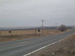
 The dark spaces are cattle
A storm was due in Taos, but we managed to beat the weather and have a beautiful morning ride east through the Sangre de Cristo. There was little snow, but the trees were covered with a heavy frost; in some places one side of the trees was frosted white while the other side was green. We even saw elk and wild turkeys feeding near the road.
 The dark spaces are cattle
Cimarron, like Dodge City and Abilene and Ellsworth, was once a terminal for cattle drovers, and was full of outlaws and gunmen anxious to have a little extra piece of the profits. For a while it was a rare week without a shooting in Cimarron. Today the town is pretty sleepy, for the days of the open range are long gone.
South of Cimarron is the 139,000 acre Philmont Scout Ranch, given to the Boy Scouts of America by a wealthy rancher, and now used for some 20,000 scouts and scout trainers from around the world each summer. We'd tell you more, but the museum had closed for the entire Thanksgiving week, so we just drove through.
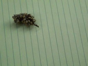
 Unknown grain
One moment we were in the mountains and the next we were in the Great Plains, or so it seemed. The hills quickly gave way to grasslands. As we headed east the rangeland soon turned to farm land, where hay and some grain were raised to feed the cattle. But of course cattle was the principal industry, and the scenery changed but little as we passed across eastern New Mexico and into the panhandle of Oklahoma. We even spotted the occasional oil well. In the panhandle, just 34 miles wide, the north-south roads tend to connect points in Kansas with points in Texas, and just incidentally happen to pass through Oklahoma.
In the distance we saw an array of buildings with some steam or smoke issuing forth. We'd like to plead failing eyesight as we age, for at first we decided it was a refinery or natural gas substation, then called it a quarry, then a mine, but we were puzzled by the black looking mass surrounding the plant. It wasn't until we were quite close that we discovered we were looking at a large feedlot and
(presumably) slaughterhouse.
 Union County Historical Park
We photographed a grain produced by a stalky plant. Can any of you farmers help us out? Is this milo? Some other grain?
Perhaps our favorite sight today was the Union County Historical Park, which seemed to consist simply of a nice green dinosaur. The park sign reminds people not to climb or lean on the dinosaur's neck.
We were surprised to drive by quite a few abandoned houses which were slowly decaying. The plows came close to these houses, but left the foundation and ruins alone. In one spot a herd of cattle had lain down among the ruins of a home. We think these homes might have been abandoned by some of the 220,000 Oklahomans who fled the Dust Bowl in the 1930s.
We spent the night in Guyon, Oklahoma. Like many small prairie towns, the downtown stores have closed their doors and boarded the windows. But Guyon is luckier than many of these towns, because there's a Wal-Mart on the outskirts, providing jobs for the townspeople.