Driving through eastern Wyoming, under a brilliant blue sky, with just a few traces of crystal-white snow on the fields, we stopped for lunch at Deacon's, in Torrington, Wyoming. It's a sprawling building, complex inside with a couple of banquet rooms, a lounge-looking room, a cafe-type room with 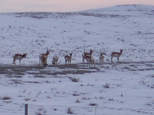 Antelope
austere booths, and a short counter facing some of the tables. At noon on Saturday most of the rooms were full, the men in baseball caps or huge black cowboy hats, their sons dressed as miniature copies. As we munched away, we enjoyed watching Merle, a bearded gent in a flannel shirt who sat at the counter and held court. First a policeman wandered by to talk about hunting, then a couple of other men exchanged a few words, then Merle shared a favorite newspaper story with the waitress, and asked about her plans and opportunities. The owner wore a green polo shirt, and managed to appear at the cash register whenever someone was ready to walk out. The cashier's place was at a little counter and the customers could just as easily walk up behind as in front. You got the feeling that somebody might have just put his payment in the till if the proprietor was busy. Deacon's was the kind of place that had just two signs on the awning: Restaurant, and Entrance. They had homemade potato with bacon soup, and homemade beef noodle soup, both excellent. We'll remember Deacons for the next time we're passing through Torrington at lunch time.
 Bison
Bison
We spent the night in Lusk -- we'd passed through here last month on our way from Nebraska to Casper -- where there was more snow and ice on the ground. A good size storm had come through on Friday, but a lot had melted. For exercise we walked a half-dozen blocks to the corner of First and Main, turned around and walked back. But the sight of the Stagecoach Museum caught our interest. They had a modern replica of a stagecoach out front, for the kids to climb, but inside, on the second floor, was the real thing. For all our stops in western museums, this was the first stagecoach we'd ever seen. Plenty of buckboards and farm wagons, covered wagons, mining carts, but never a stagecoach till today. They were ready to close, so we didn't have time to look around everywhere, but they had lots of interesting items.
We left around 7:30 next morning, eager to see the Black Hills of South Dakota. Our truck has a display on the rear view mirror which shows the direction we're heading and the outside temperature. It started out at 26, dropped to 12 near Mule Creek Junction, then climbed back up to the high 40s near Rapid City. The snow was a little deeper here, but the roads still clear. It's a lovely time to visit.
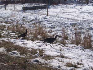 Wild turkeys
The snow makes it easier to spot wildlife at a distance, although the pronghorns white-and-tan coloration gives them camouflage summer and winter. We're getting better with the 3x optical, 3.3x digital zoom on our camera, and got some nice closeups today. It certainly was helped by the fact that the wildlife didn't seem bothered much by our presence!
Still heading north on U.S. 85, we saw -- unbelievably -- a beautiful large fox by the side of the road. We did a u-turn, and got up alongside, window down. The fox had hunkered low in the snow, trying to look like a rock, but we wanted a picture. He rose, swished his tail and trotted back into his field, occasionally turning to check that we were still there.
Next we found some mule deer browsing not far from the road -- but we saw deer repeatedly throughout the day. Of course it's hunting season, so we only spotted the does and fawns; the bucks are trying to stay away from people for a while.
Hot Springs is another old resort town, which evidently still attracts some vacationers to try the waters. The brick and stone hotels and bathhouses appear to date from the first half of the twentieth century; modern-day resort builders are catering to different tastes.
We stopped at the Wind Cave National Park to get an idea of local road conditions. Needles Highway was already closed for winter, but Iron Mountain Road was open, so we decided to try that.
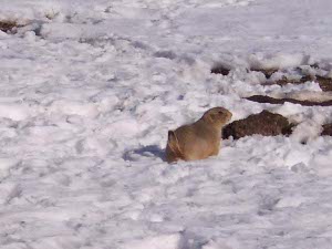 Prairie dog
On the way into the Park we saw a sign, "Large Animals On Road," just as the speed limit dropped, and we pulled over to catch a closeup shot of a bison. There were no fences between us and this huge, hairy beast. A few hundred yards further we came upon a large prairie dog village. In fact, this area was full of them, and the prairie dogs obligingly came out of the burrows and posed for us. Tracks in the snow between all the different burrow entrances made the whole village look like a giant Tinkertoy network.
Next we saw wild turkey, and later a turkey hunter, just outside the refuge, and Rocky Mountain bighorn sheep grazing along the roadside in Custer State Park, along highway 87. We stopped at a pullout by another prairie dog village and when we rolled down the window heard the critters giving their alarm squeals, all out near the entrance to their burrows. We pulled out the binoculars and saw, in the distance, the reason: a large coyote was making lunch from one of the little animals. In the photograph, however, you can only tell that it is a coyote; not what he is doing.
By this time we were giggling with joy over so much wildlife to see and photograph, that we almost didn't see the three mules standing in the middle of the highway. Don't ever let anyone tell you that mules are dumb. They had carefully arranged themselves along the centerline of the narrow, two-lane road. Two were jet black, the third grey. Other mules sat quietly in the snow nearby. As we slowed down to pass, the mules turned lazily and slowly made 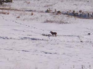 Coyote
space for us to get by, creeping along, and then started toward the truck, expecting to stick their heads through the window to be fed. We were so flustered by their approach that we failed to get the gigantic closeup picture of a mule's head, but you can imagine what that looks like!
Highway 16A runs north from Custer State Park to Mount Rushmore; this section is called the Iron Mountain Road, and it was designed, at least in part by a former South Dakota Governor and senator, Peter Norbeck. This portion of the Black Hills is reminiscent of West Virginia -- not huge mountains, but ups and lefts and rights and downs all mixed up in rapid succession so you feel like you're navigating some complex strand of twisted spaghetti as you drive. Norbeck, an enthusiastic conservationist, designed pigtail bridges, which curve around and loop over themselves, to go up and down the hills. They were built during the Depression by CCC crews. There are at least three pigtail bridges and three one-lane tunnels on the road, cut through the rock outcroppings. Through the first tunnel you get a bullseye view of Mount Rushmore in the distance. We certainly recommend the Iron Mountain Road, south to north.
While we agree that Washington, Jefferson, Lincoln, and Roosevelt were four of our greatest presidents, we can't really see the sense of all the 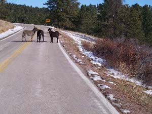 Three mules (or burros)
hoopla about Mount Rushmore as a tourist destination. We saw the mountain up close in 1965, and, other than satisfying ourselves that it was still there, there was no need to go to the visitor center, let alone the dozens of tourist traps (Reptile Garden!!! Bear Country USA!!! Wax Museum Of The Presidents!!!) that have sprung up near the monument, along with Fine Dining and Fine Shopping for Black Hills Gold! For those not fully sated, there is an evening light show, during which "Banks of huge floodlights illuminate The Faces for about two hours." We realize that other tourist attractions, such as the Tour Eiffel, also have Light Shows, but Mount Rushmore??? Good Grief!!! If the National Park Service takes credit for all this commercialization, well, then, shame on them!
Far more interesting is studying the history of the Black Hills, the Gold Rush of the latter 1870s, accompanied by war between the Sioux and the settlers (the Sioux, of course, were fighting to defend their own reservation land granted by treaty) and the beautiful scenery and wildlife. More about this in our next report, if we ever get it written.
 Antelope
austere booths, and a short counter facing some of the tables. At noon on Saturday most of the rooms were full, the men in baseball caps or huge black cowboy hats, their sons dressed as miniature copies. As we munched away, we enjoyed watching Merle, a bearded gent in a flannel shirt who sat at the counter and held court. First a policeman wandered by to talk about hunting, then a couple of other men exchanged a few words, then Merle shared a favorite newspaper story with the waitress, and asked about her plans and opportunities. The owner wore a green polo shirt, and managed to appear at the cash register whenever someone was ready to walk out. The cashier's place was at a little counter and the customers could just as easily walk up behind as in front. You got the feeling that somebody might have just put his payment in the till if the proprietor was busy. Deacon's was the kind of place that had just two signs on the awning: Restaurant, and Entrance. They had homemade potato with bacon soup, and homemade beef noodle soup, both excellent. We'll remember Deacons for the next time we're passing through Torrington at lunch time.
 Bison
Bison
 Wild turkeys
 Prairie dog
 Coyote
 Three mules (or burros)