In Oroville, California we stopped at the Oroville dam. The dam was 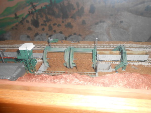 Model of dam building car
built in the mid-1960s, using some innovative automated technology. Powerful machines filled specialized rail cars with dirt and stone, which were then pulled up the slope to the hilltop and automatically dumped, making one of the largest earthen dams ever built.
Lake Oroville itself is a "finger shaped" reservoir, as is so common in the West, with its many narrow canyons. It is one of California's larger reservoirs, and a vital part of the water management system for the state.
The hills above Oroville up towards Mount Lassen were the home  Lake Oroville
of the tiny Yahi Indian tribe, which was ruthlessly massacred by the California settlers, until in 1911, one dark-skinned native stumbled into Oroville. His language was unknown to scholars, who called him Ishi, which they discovered was the word for "man" in that language. During the next five years, until his death from tuberculosis at age 55, Ishi willingly cooperated with University of California anthropologists who learned a little of his language while Ishi learned a few hundred words of English and eagerly described his
 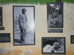 Pictures of Ishi
native culture, even leading men to his living place. The story was all documented in the Lake Oroville Visitor Center.
At Bryan's suggestion, we continued up California 70 along the north fork of the Feather River canyon. A truly beautiful ride, little traffic, beautiful views of the canyon and river and many hydroelectric stations.
There's a railroad going up the same canyon, which is often on 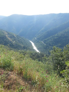 Feather River Canyon
the other side from the highway. Both go through tunnels and pass over impressive bridges and viaducts. So your engineering nerves get tingled just as much as your aesthetic ones!
We spotted some waterfalls, and no gas for one stretch of 56 miles (not a problem these days, but the first automobile tourists probably worried). In Quincy we turned onto Forest Road 119 through the Plumas National Forest, which returned to Oroville another way, 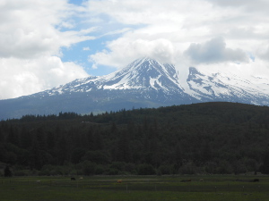 Mount Shasta
this time passing large areas which still had feet of snow on the ground, despite it being the middle of May with Oroville temperatures in the high 80s!
We took a ride the next day through the countryside near Yreka. First we headed north on Highway 263, which was a lovely mountain ride near the Shasta River.
We turned left on Highway 98, which follows the Klamath River flowing west toward the Pacific. This is a lovely mountain river, 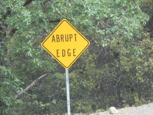 Highway sign
full of water, many rapids, must be good for rafting.
We slowly descended alongside the river until the town of Hamburg, where we turned left on Scott River Road. This ascended the Scott River, naturally, and soon turned into a much narrower and occasionally thrilling road (see the road sign!)
May, it turns out, is a grand time to move along through the mountains. The roads are clear and not too crowded, the weather is right for short walks, and here and there patches of snow remind us that winter did not end that long ago.
 Model of dam building car
built in the mid-1960s, using some innovative automated technology. Powerful machines filled specialized rail cars with dirt and stone, which were then pulled up the slope to the hilltop and automatically dumped, making one of the largest earthen dams ever built.
 Lake Oroville
 Pictures of Ishi
 Feather River Canyon
 Mount Shasta
 Highway sign